
In the case of collecting groundwater elevations, the form generated by the server includes a listing of wells on the site and spaces to input "Depth to Water" measurements and field notes.
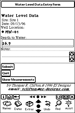
Screenshot of water level data entry form.
In the field, the geoscientist selects the well being measured and enters the depth to water and any notes. This information is transmited back to the site database where it is entered and compared to the previous measurement. If measurement exceeds the average variation, the server reports this and requests an additional measurement.
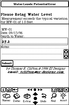
Screenshot of water level data entry form reporting a potential data entry error.
The server requires that any subsequent measurements must be within the average variation for that well. This simple error checking can remove costly and potientially embarassing field data collection errors.If the new measurement lies within the average variation in that particular well for the sample interval the measurement is accepted and the geoscientist is directed to proceed to the next well. The well list for the site is automatically updated to show the field geoscientist the remaining wells to measure.
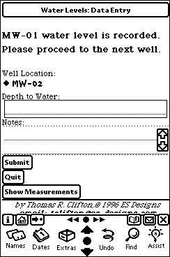
Screenshot of water level data entry form reporting acceptance of the entered value.